Hiking the Y in Provo
Last Updated on March 14, 2024 by Kathryn
Hiking the Y in Provo is a super popular trail for families. Climb to the top of the “Y” on the mountain and enjoy expansive views of Utah Valley.
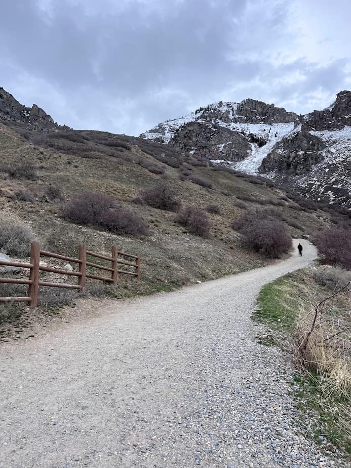
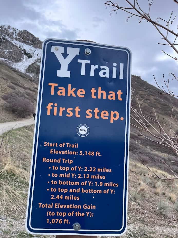
At just over 2 miles, the trail is short, but don’t mistake this for an easy hike! It’s steep with an elevation gain of over 1,000 feet in about 1 mile. Don’t let that stop you, though!
There are so many great hikes in Provo, and Hiking the Y is a fun one.
This post may contain affiliate links, which means I’ll receive a commission if you purchase through my links, at no extra cost to you. Please read full disclosure for more information.
At a Glance
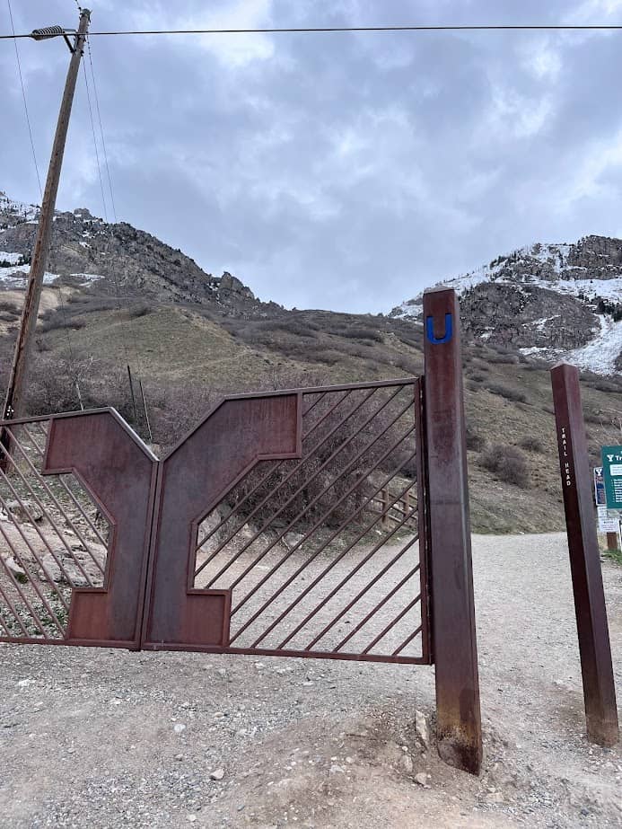
Location: The trailhead is on the east bench of Provo. Coordinates: 40.245005955209564, -111.62729266929362.
Note: if you put “Y Mountain” or “Y Hike” into Google Maps, it will take you to the wrong place. Use the coordinates or “Y Trailhead”.
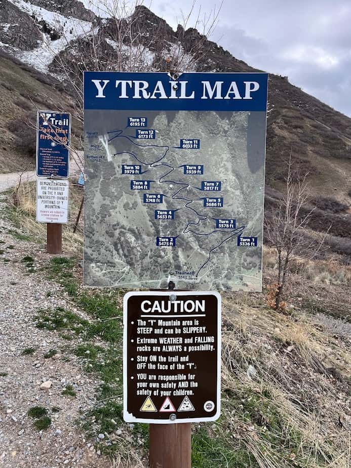
Mileage: 2.2 miles out and back to the Top of the Y
1.9 miles out and back to the Bottom of the Y
Elevation Gain: 1092 feet
Good for Ages: 5+ (depending on the child!)
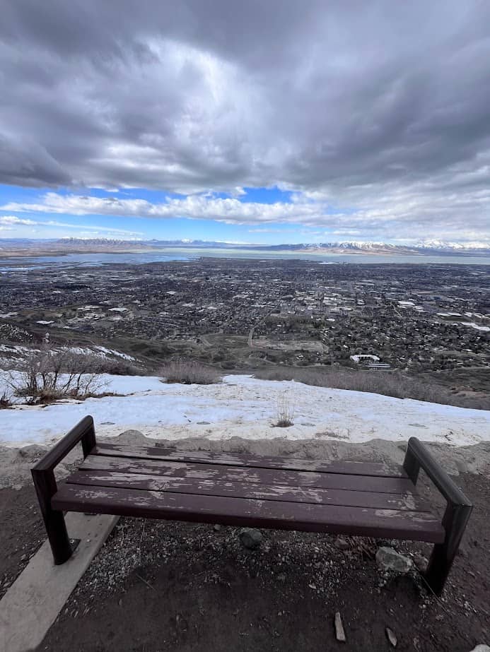
What You’ll See: The giant Y, views of Provo, Utah Lake, and Utah Valley
Popularity Level: High, especially on holidays, or summer.
Good to Know: Very busy on holidays.
Free parking. There are several parking lots, so even on busy days you should find a spot.
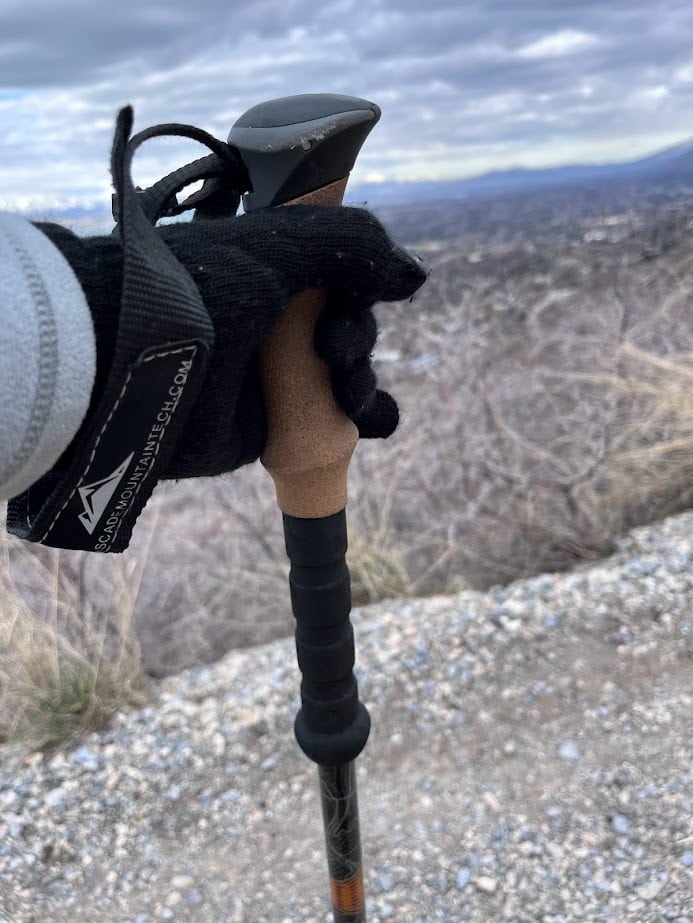
The trail is steep! Hiking poles are helpful, especially going downhill.
The trail is exposed to the sun, so if you hike it on a hot day, try to do it before the sun comes up over the mountain, or in the evening. And bring lots of water!!
The views are incredible at sunset!
There are bathrooms at the trailhead, open year-round.
Local tip: Grab some ice cream at the BYU Creamery on Ninth when you’re done! (Graham Canyon is the best.)
What’s the Big Deal with Hiking the Y?
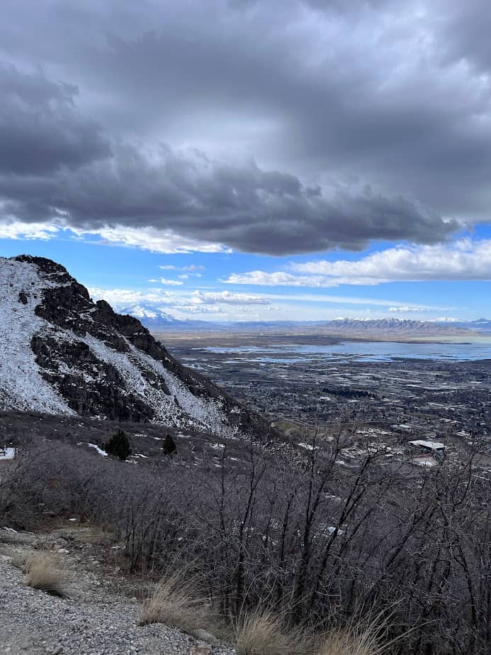
If you’ve ever been to Provo, you’ve seen the giant 380 foot tall concrete “Y” on the side of the mountain. It stands for Brigham Young University (BYU) and looms large over the school.
The first Y was constructed in 1906! Students at BYU maintained it for decades and now hiking to it is a right of passage for locals and college students alike.
The hike itself is not all that pretty. The dusty gravel trail cuts up the mountain through scrub oak. However, the views are awesome! You can see Mount Timp to the north, Utah Lake and the Lake Mountains to the west, Mount Nebo to the South, and everything in between.
The best time to hike it is at sunset. Those colors over Utah lake are quite the site!
Hiking the Y with Kids
This hike can certainly be done with kids! I’ve done it many times with mine.
Keep in mind that it’s quite steep, so gauge your child’s ability. I had one child climb it at age 3, but I know that another child won’t be able to do it until closer to age 5 (or 6 or 7…we’ll see).
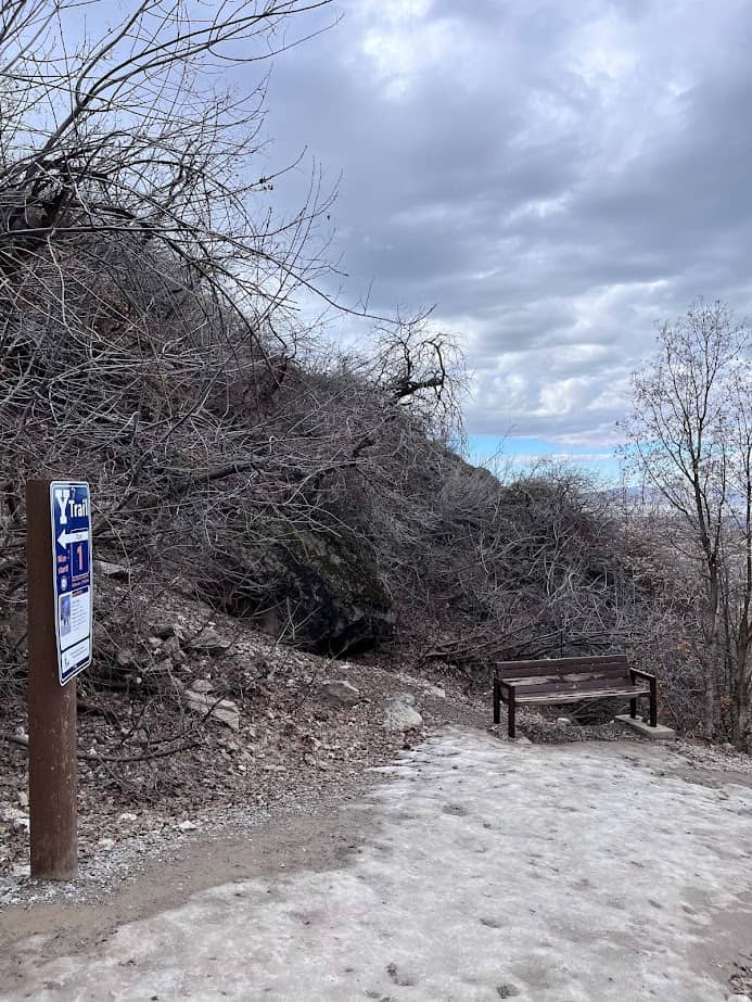
There are signs at several of the 13 switchbacks along the gravel trail, which are fun for kids to count off. They also make good spots for water breaks!
Be aware that there are some very steep sections of the trail that can be difficult if you are carrying a kid in a backpack. The gravel is slippery, so be careful with running down the trail.
Tips for Hiking the Y
Every time I hike it, I see runners booking it up the trail…good for them. For the rest of us, it’s a workout without running.
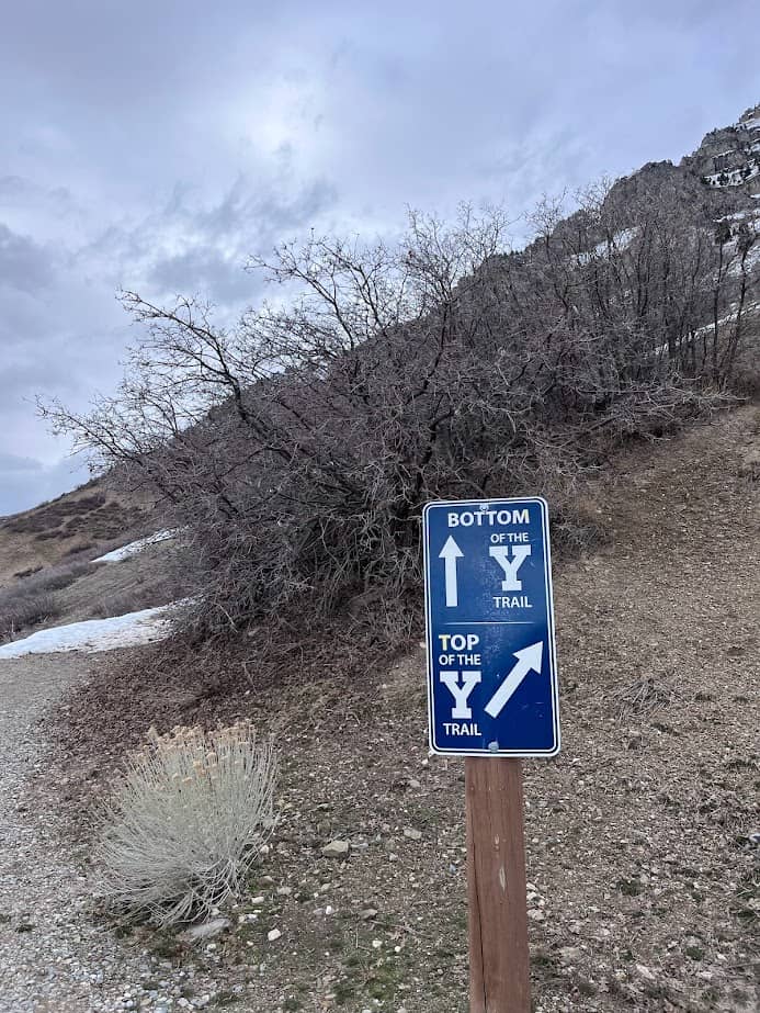
Signs at some of the switchbacks indicate how far you’ve gone. Once you get to #10, you can choose to either go left to hike a flat 0.1 miles to the bottom of the Y or right to hike uphill 0.2 miles to the top of the Y. There’s also a path to the middle of the Y.
There are picnic tables and plenty of benches along the Y Trail to stop and catch your breath or enjoy a snack. Or bring a dinner and enjoy watching the sun go down.
Keep in mind that hiking on the concrete Y is not allowed.
How Long Does it Take to Hike the Y?
According to AllTrails, it takes an average of 1 hr 46 minutes to hike the Y. However, I’ve done it in about an hour hiking at a moderate pace. If you’re with young kids, I’d plan on closer to 3 hours. Remember, it’s short but steep!
When to Hike the Y
Summer: Expect heat and sun. It’s pretty miserable to hike it on a hot day unless you go very early or late.
Spring: May be muddy, but generally a good time to hike it.
Fall: As with most fall hikes near Provo, this time of year is usually perfect!
Winter: There may be ice or snow, but there are usually many days without it. The side of the mountain is exposed to the sun during the day and much of the snow melts. I hiked it in February and did not need spikes.
Holidays: Memorial Day and Labor Day are packed!
Get Outside!
I hope you’re encouraged to get out – far and wide – with your family!